The Arsenal That Gets the Job Done
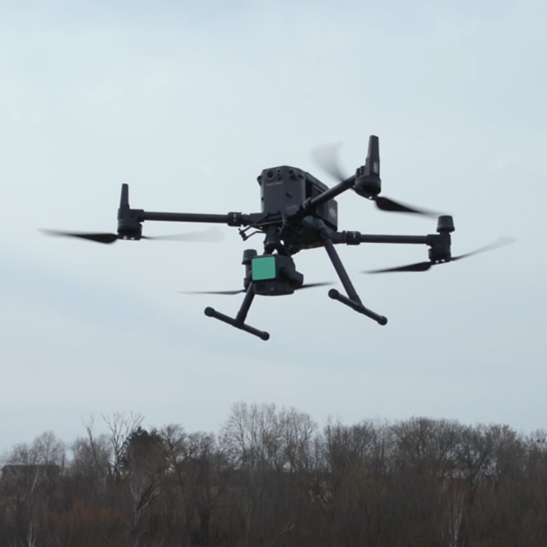
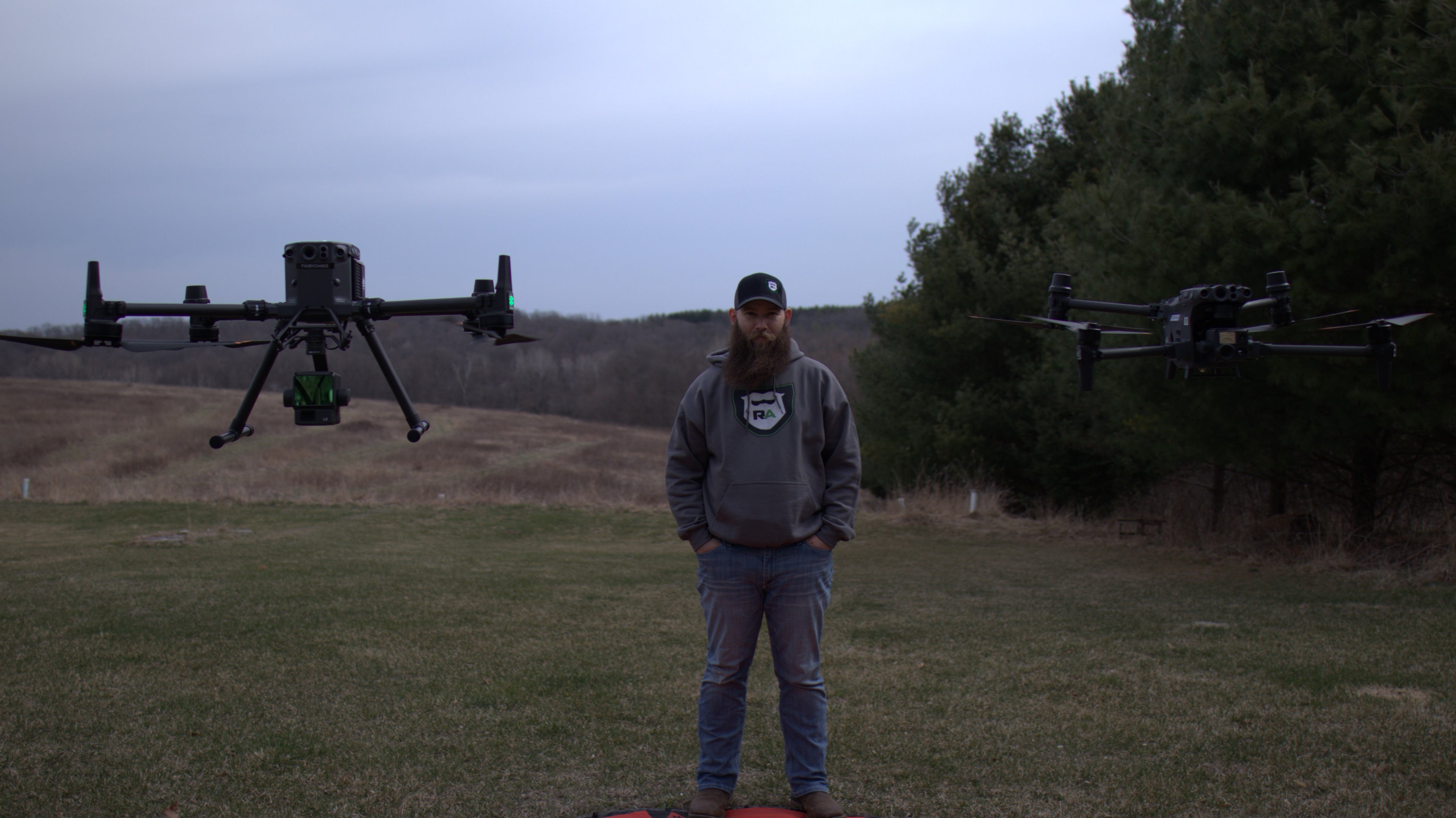
Matrice 350 RTK (M350 RTK)
The workhorse. With RTK precision, hot-swappable batteries, and all-weather durability, this beast handles high-stakes missions without breaking a sweat.
Used for: LiDAR, thermal, night ops, long-haul mapping.
Specs: DJI M350 RTK
Precision meets endurance. Built for the wild.
Let’s Talk Gear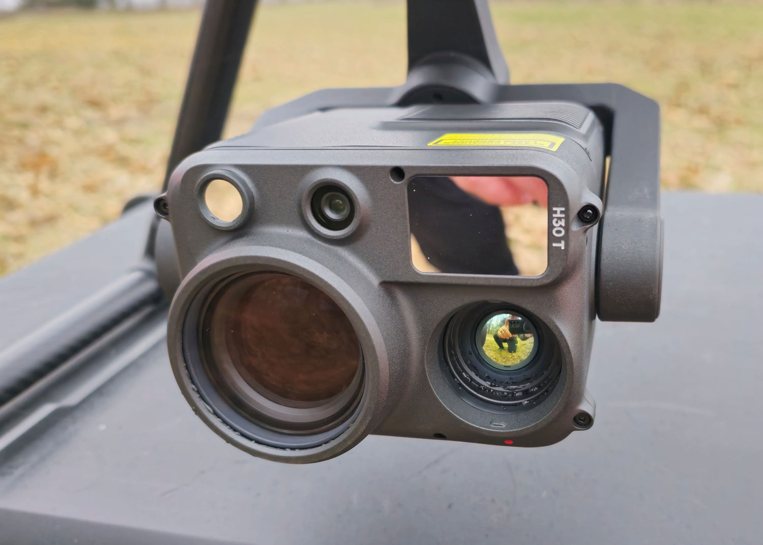
Zenmuse H30T Payload
RGB + thermal + laser rangefinder in one versatile sensor. From wildlife/pet recovery to rooftop heat loss, this hybrid lens sees what others miss.
Used for: Recovery, inspections, utilities.
Specs: Zenmuse H30T
See heat. Read distance. Get clarity.
Let’s Talk Gear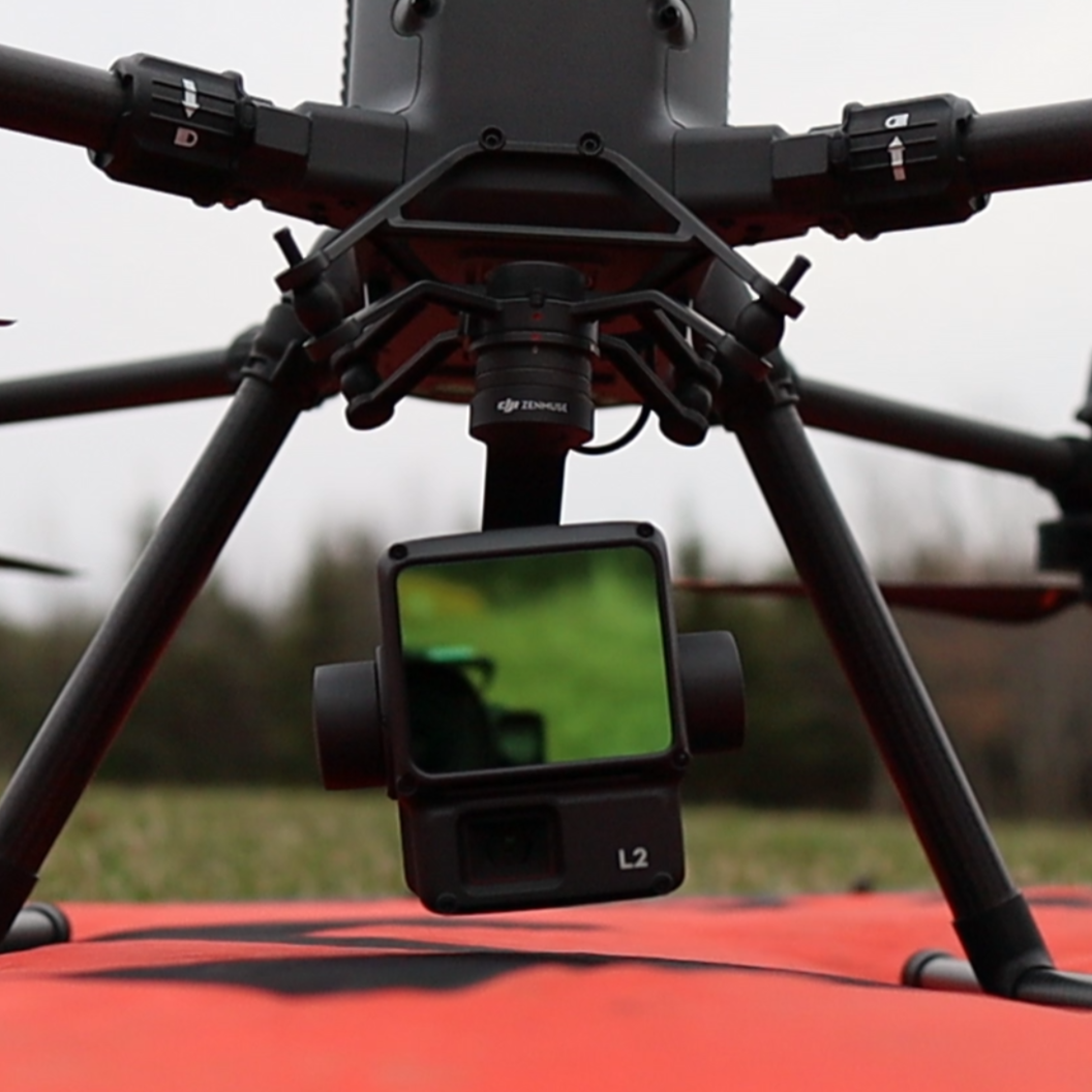
L2 LiDAR Payload
When accuracy matters, we bring the L2. With millimeter-level data capture and dense vegetation penetration, it turns terrain into insight in a single pass.
Used for: Land mapping, forestry, volume calcs.
Specs: Zenmuse L2
Survey-grade detail. Zero ground disturbance.
Let’s Talk Gear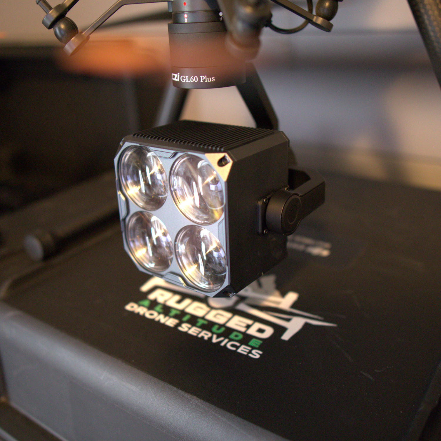
GL60 Plus Spotlight
When your mission goes dark—literally—this is your beam of hope. The GL60 Plus delivers powerful, pinpoint illumination, cutting through darkness with laser-like focus. Ideal for locating heat signatures, inspecting infrastructure, or lighting up a field in seconds.
Used for: Night recoveries, inspections, law enforcement support
Specs: GL60 Plus
Punch through the dark. Illuminate the mission.
Let’s Talk Gear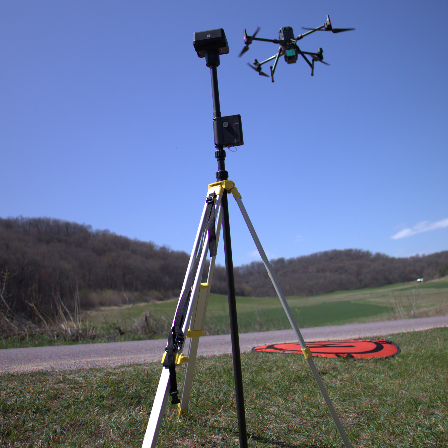
D-RTK 2 High-Precision GNSS Mobile Station
When mapping demands are sky-high, this is your ground game. The D-RTK 2 enhances RTK accuracy in the field, unlocking centimeter-level precision in remote, rugged terrain—even when conditions aren’t ideal.
Used for: Mapping, LiDAR, orthomosaic mapping, terrain modeling
Specs: D-RTK2 Mobile Base Station
Your map doesn’t lie when your data’s this accurate.
Let’s Talk Gear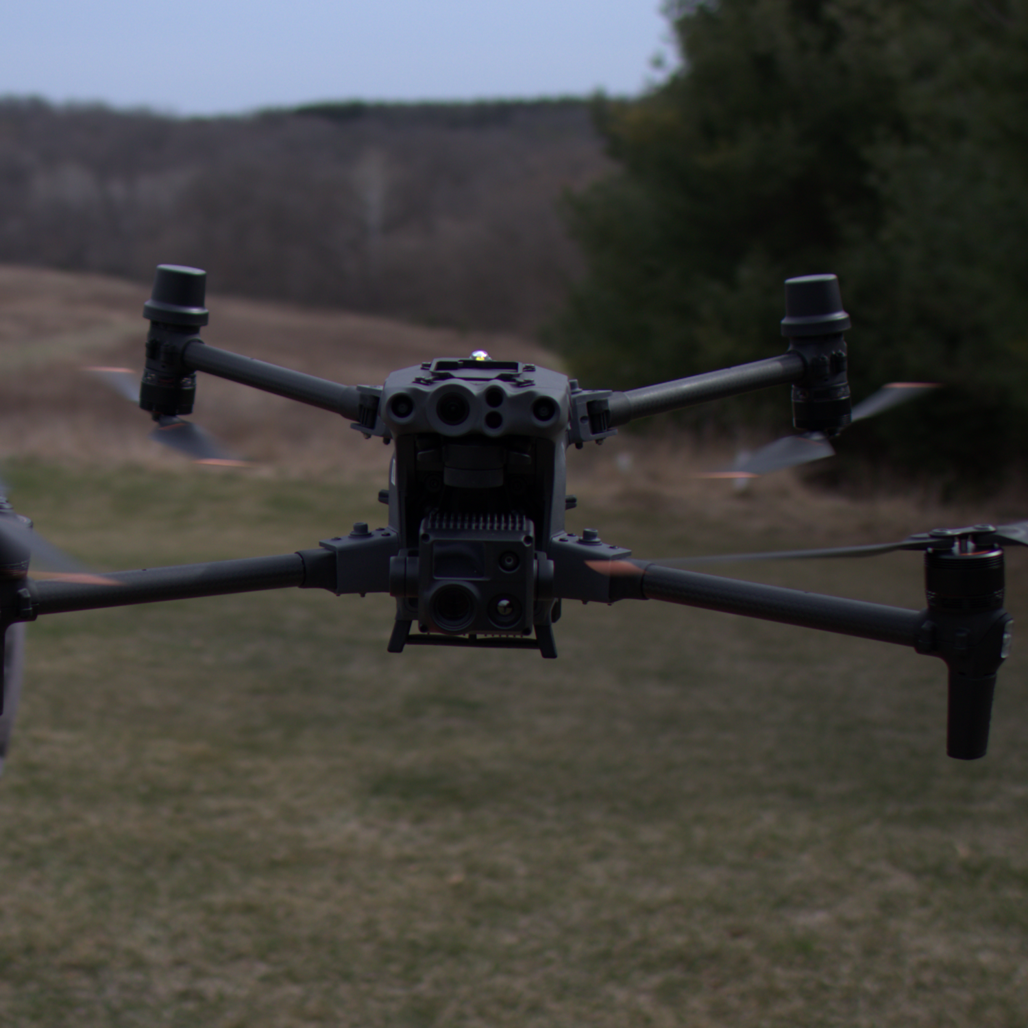
Matrice 30T (M30T)
This isn’t your average field drone—this is your fast-deploy, high-mobility recon platform. With thermal, RGB, laser rangefinder, and weather-sealed design, the M30T is built for speed, agility, and clarity when time matters most.
Used for: Fast recoveries, inspections, wildlife monitoring, rapid deployment
Specs: DJI M30T
Thermal, zoom, and range—all in one compact powerhouse.
Let’s Talk Gear